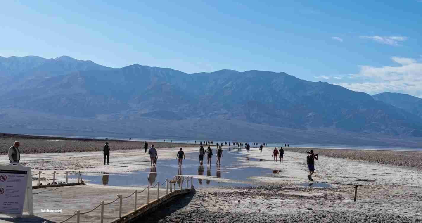
Ancient Lake Manly Returns to Death Valley: Badwater Basin Flooded Again After Months of Heavy Storms
An ephemeral form of ancient Lake Manly has reappeared in Death Valley’s Badwater Basin after months of heavy storms, transforming the salt flats into a shallow temporary lake and drawing widespread public and scientific attention.
- Rare reformation: Heavy storms produced a shallow, reflective lake over the Badwater salt pan.
- Confirmed by satellites: NASA Earthdata imagery shows the standing water.
- Park protections: The National Park Service banned boating and urged visitors to avoid soft salts and mud to prevent long-lasting damage.
What is Lake Manly and why it matters
Lake Manly is the informal name for a Pleistocene pluvial lake that once filled much of Death Valley under a much cooler, wetter climate. Today, the term describes the thin, short-lived sheet of water that forms on Badwater Basin after rare, intense storms.
At its peak in the Ice Age, the ancient lake stretched for many miles and reached depths of hundreds of feet. The modern recurrence is shallow — usually only inches to about a foot — but the visual impact is dramatic: the normally white, polygonal salt crust becomes a dark, reflective sheet of water extending for miles, drawing photographers, scientists and curiosity-seekers.
How the lake reappeared after Hilary and subsequent storms
In August 2023, the remnants of Hurricane Hilary delivered roughly 2.2 inches of rain to Death Valley in a single day, roughly equivalent to a year’s normal park rainfall, temporarily filling Badwater Basin and producing a modern Lake Manly.
Subsequent storms, including an atmospheric river in early February 2024 that added about 1.5 inches, refilled and expanded the basin. At times water extended to roughly 6 miles long by 3 miles wide and approached a foot deep in places, allowing brief boating and kayaking when conditions permitted (National Park Service).
Wind-driven movement, mud flats and rapid change
Strong winds in late February and early March pushed the shallow water northward, spreading the same volume over a larger area and reducing depth. Winds near 40 mph carried the “traveling lake” roughly two miles north, increasing evaporation and exposing muddy flats where boats had launched.
“The net result was shallower, muddier water over a wider area and damaged crust in places where visitors had walked or dragged boats.”
When winds calmed, water sloshed back toward the basin center. That cycling left widespread muddy patches and areas of damaged salt crust, visible long after water levels fell.
National Park Service response and warnings
Park staff documented footprints and drag scars in soft sediments and warned that such marks can persist for years. The NPS banned boating under current conditions and advised visitors to:
- Use already compacted paths from the Badwater parking area.
- Avoid walking across uncompressed salt and mud.
- Respect closures and stewardship guidance to preserve natural polygons and prevent long-term scarring.
Satellite confirmation and scientific interest
NASA’s Harmonized Landsat–Sentinel-2 (HLS) imagery clearly shows a dark-blue water body within Badwater Basin after the recent storms, confirming significant standing water over the salt flats. Scientists emphasize this is not a return to the Ice Age lake but an example of how short, intense storms can reactivate ancient basins in hyper-arid regions (Outside Online).
Researchers can now study surface processes, salt crust dynamics, sediment transport and evaporation in a normally dry landscape — valuable for understanding extreme-event impacts on arid ecosystems.
Visitor behavior, stewardship and legal limits
The flooding renewed debate about balancing public access with protection. Officials stress that while visitors are welcome, they must follow park rules. Boating was banned because dragging vessels and walking on soft sediments cause lasting harm. The NPS advises sticking to compacted trails and avoiding fragile crust.
Conservative stewardship reminder: Respectful, rule-abiding visitation protects these shared public lands for future users and the local economy.
Implications for Utah
Economic impact
Images of Lake Manly may spur regional travel from Utah residents, boosting guide services, gear shops and lodging. Increased visitation can provide revenue but also raises maintenance and protection costs for federal agencies and nearby communities.
Political and governance consequences
The NPS response — including bans and enforcement — will draw attention from stakeholders who favor stronger local input on public lands. This episode could inform discussions on managed access, enforcement resources, and partnerships between federal agencies and local stakeholders.
Social and safety effects
Sudden surface changes increase travel risk. Utah families planning cross-state trips should monitor NPS alerts and road conditions; park closures or restrictions can disrupt itineraries. Carry water, communications, and vehicle recovery gear when traveling in the Southwest.
Cultural relevance and values
The reappearance of Lake Manly highlights values around conserving public lands and preserving natural spectacles with minimal human impact. It also provides educational opportunities for schools, scout groups and outdoor clubs.
Practical applications for Utah travelers
- Check official sources before travel: National Park Service — Death Valley.
- Plan for restrictions: expect boating bans and avoid soft sediments.
- Pack safety gear: water, communications, vehicle recovery tools and updated maps.
- Support local businesses responsibly and follow park guidance to minimize environmental impact.
Sources and further reading
Preserved references and original reporting: