
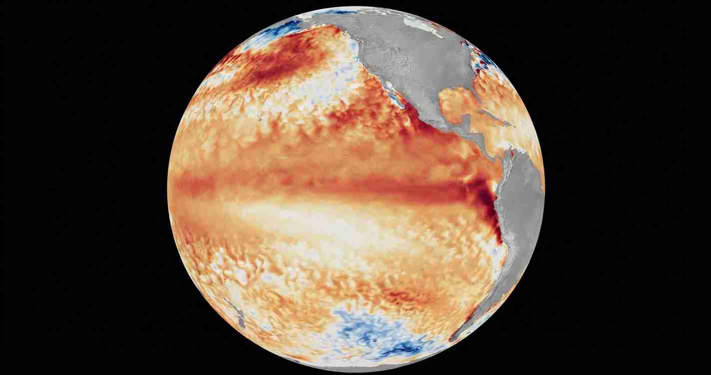
WASHINGTON, July 7 (San Diego News Online) — NOAA forecasters say El Niño conditions are now present in the tropical Pacific and are expected to strengthen through the Northern Hemisphere winter of 2026-27, according to the Climate Prediction Center’s latest advisory. For people tracking weather-sensitive plans, that means the most important next step is to watch NOAA’s seasonal outlooks, especially if your home, travel, farming, or coastal interests depend on winter weather patterns.
What NOAA says
The Climate Prediction Center, part of NOAA’s National Weather Service, has issued an El Niño Advisory. In its June 11 diagnostic discussion, the center said El Niño conditions developed over the prior month and that sea surface temperatures are running above average across the central to eastern equatorial Pacific Ocean.
The CPC said its latest weekly Niño-3.4 index was +0.7 degrees Celsius, with the Niño-4 index also at +0.7 degrees Celsius and the Niño-1+2 index at +2.1 degrees Celsius. Those numbers measure how much warmer or cooler a key part of the tropical Pacific is than usual.
In the same advisory, NOAA said its North American Multi-Model Ensemble, including the NCEP CFSv2 model, points to El Niño intensifying into winter 2026-27. The agency said there is a 63% chance of a very strong El Niño during November-January, which could put the event among the largest on record since 1950.
What El Niño means
El Niño is one phase of ENSO, the El Niño-Southern Oscillation. It describes how sea-surface temperatures in the equatorial Pacific interact with the atmosphere above it. When waters in the central and eastern tropical Pacific become warmer than average, that can shift global weather patterns.
NOAA’s Climate.gov explains that forecasters use a set of ocean and atmosphere measurements to identify El Niño, including warm sea-surface temperatures in the Niño-3.4 region. The agency’s education material says the phenomenon is part of the normal climate cycle, not a storm or a single weather event.
How it develops
According to NOAA’s technical summary, above-average sea-surface temperatures first appeared in the far eastern equatorial Pacific in early February 2026. By mid-April, the warmer waters had expanded across the central to eastern Pacific.
NOAA says that evolution matters because El Niño is not declared from one warm week alone. Forecasters look for a sustained pattern of ocean warming and related atmosphere changes before saying the event is underway.
The International Research Institute for Climate and Society at Columbia University also says El Niño conditions are strengthening across the tropical Pacific and expects the event to continue intensifying. Its June 17 update listed the weekly Niño 3.4 index at +1.7 degrees Celsius.
What it can change in the U.S.
El Niño does not cause the same weather everywhere, and NOAA does not treat it as a guarantee of any one local outcome. But it can tilt the odds.
NOAA’s National Weather Service says El Niño can influence U.S. temperatures and precipitation patterns, especially during winter. In some years, that means different storm tracks, warmer or cooler stretches, and changes in rain and snowfall depending on the region.
NOAA’s Ocean Service says an El Niño pattern can also affect coastal flooding risk in some U.S. locations by contributing to higher-than-normal water levels during high tides.
For Washington and the broader Mid-Atlantic, the practical takeaway is to follow NOAA’s winter outlooks rather than assume one fixed outcome. El Niño is a climate signal, not a local forecast on its own.
Why the timing matters
The current NOAA advisory points to the Northern Hemisphere winter 2026-27 as the period when El Niño is expected to strengthen. That timing is important because seasonal weather impacts are usually most noticeable during the colder months, when the jet stream and storm tracks are more sensitive to Pacific sea-surface temperatures.
NOAA’s forecast language is cautious: the agency says El Niño is present now, likely to strengthen, and has a substantial chance of becoming very strong later in the season. But it still stops short of promising exact winter conditions for any city or state.
What readers should watch next
The most useful next step is to keep an eye on NOAA’s seasonal outlooks, local National Weather Service forecasts, and coastal flood information if you live near the water. If the pattern continues to strengthen, forecasters will update the public on how it may affect winter temperatures, precipitation, and flood risk.
For now, NOAA’s message is straightforward: El Niño is underway, and the odds favor a stronger event by winter.
